
GVF Living Laboratory is in its second year of a Land Use Research Agreement with the University of Oklahoma. These unmanned aerial vehicles (UAVs) equipped with weather-related sensors and high-resolution optics will serve to retrieve otherwise unobtainable field-data to be transmitted in real time to the OU Weather Center and National Storms Lab for algorithmic modeling and digital weather predictions. Working in collaboration with the meteorologists at OU (the university has over 60) the goal is to better understand the precursors and physics inherent in the early formation of tornadoes and extreme weather events. This will help to ensure people, especially children, have enough time to reach a safe place.
Jamey Jacob/Oklahoma State University
A major focus for OU this coming year will be the $166 million NASA grant for a geostationary carbon cycle observatory. The OU Grant uses eddy covariance methods to measure the exchanges of carbon dioxide (CO2), water vapor, and energy between terrestrial ecosystems and the atmosphere. The study will examine the natural sources and processes that control carbon dioxide, carbon monoxide, and methane which are present in the earth's atmosphere. Some of the most sophisticated infrastructure and instrumentation will be located at GVF Living Laboratory.
DII - Atmospheric Sciences, LLC, in partnership with GVF Living Laboratory, is developing technologies to assist with next generation weather modeling and forecasting tools for targeted industries and clients. Technologies include next generation robotic and unmanned systems sensor platforms along with "crowd-sourced" weather collection systems.
Additional research priorities related to Weather Science & Atmospherics for GVF Living Laboratory are as follows:
- The 121-station Mesonet network throughout Oklahoma (one of few in the nation) is currently utilized to retrieve weather data in near real-time, e.g., temperature, humidity, barometric pressure, wind speeds and precipitation, notably for agricultural and enhanced local weather predictions. Plans are currently under way to locate a new more robust meteorological tower (met/flux) in near-proximity to the GVF Living Laboratory unmanned systems runway. In addition to the weather data outlined above, the met/flux tower would include sensors that monitor rain and solar radiation along with momentum flux, and sensible heat flux. As mentioned above, some of the potential applications are:
- Employment of “eddy covariance” methods to measure the exchanges of carbon dioxide (CO2), water vapor, and energy between terrestrial ecosystems and the atmosphere.
- Meteorological studies, including radar, for the electromagnetic spectrum to facilitate aerospace-related numerical weather forecasting.
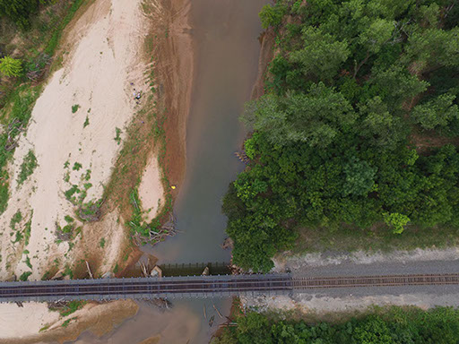
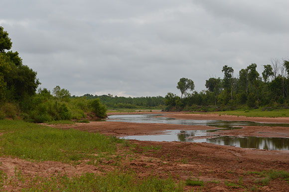
- River instrumentation and monitoring using UAVs to develop predictive-modeling for the morphodynamic changes in waterways after varying storm events; also, to calibrate the balance of sediment and water when droughts and floods severely impact fluvial conditions. This research is important in developing accurate methodologies for measuring and modeling river bathymetry, velocity profiling and suspended sediment loads.
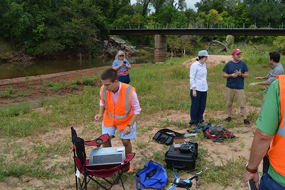
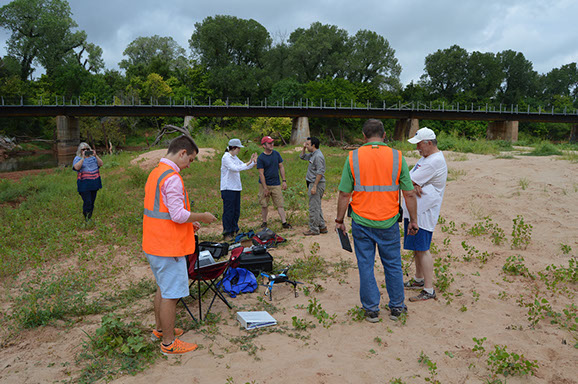
- The value of Lower Atmospheric Sampling: Atmospheric conditions are both complex and highly-variable in time and space; so, in short, more data are needed. For example, the ability to collect vertical samples of temperature, humidity, pressure, and wind with sophisticated UAVs is a game-changer.
The commentary and pictures in the slideshow below were provided by Dr. Philip Chilson, Professor, School of Meteorology & Atmospheric Radar Research Center, University of Oklahoma.

3 - 8
<
>
"The atmosphere near the surface of the Earth is directly impacted by heating, levels of moisture, features in the landscape and such. The layer of the atmosphere that is impacted by the surface is called the atmospheric boundary layer (ABL) or planetary boundary layer (PBL). The depth of the ABL depends on the time of day and conditions. it is typically shallow during the night and reaches its maximum during the day. A typical ABL height in OK in the summer can be about 5,000 - 10,000 ft. The ABL is amazingly and fascinatingly complex and highly variable in time and space. Therefore, it has been difficult to model.
However, the ABL is an important driver of how the atmosphere evolves, and as such it is important to understand the state and evolution of the ABL. To achieve this MORE DATA ARE NEEDED. This is widely known and there have been high level reports stating this conclusion. But collecting the data in the ABL has been challenging. The ability to collect vertical samples of temperature, humidity, pressure, and wind with UAS offers exciting prospects. We are trying to address such questions as: 1) how can we best collect these data using UAS; 2) what would be the optimal spacing horizontally and frequency in time of the samples; 3) how can we work with the FAA to allow us to collect these data autonomously and unattended; 4) how can we best assimilate the data into models, and so forth.
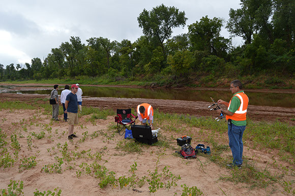
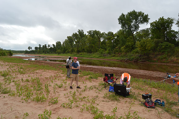
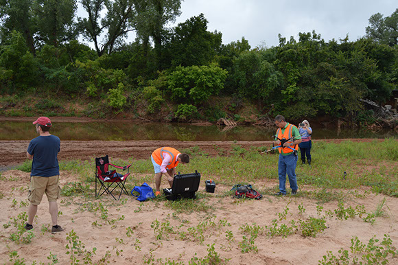
We have been collecting most of our measurements near the Washington Mesonet tower at the OU Kessler Atmospheric and Ecological Field Station so we can have a reference point for our data. But, as we gain confidence in our system, it will be important to begin exploring how diverse landscapes such as those found at GVF impact the atmosphere. This is a very abbreviated version of what we are working on. During the flights on Wednesday, we were hoping to collect data with four “identical” sensors that record pressure, temperature, and humidity. We wanted to examine the response of the sensors based on different placements on the UAV. Unfortunately, two of the four did not record."
located in Cleveland & McClain Counties, Oklahoma
PARTNERS